

«Simulador del Sistema Mundial de Socorro y Seguridad Marítimos (SMSSM)»
Vox Maris es un simulador avanzado para entrenamiento de operadores del Sistema Mundial de Socorro y Seguridad Marítima (GMDSS), diseñado para cumplir con las normativas y recomendaciones de la Organización Marítima Internacional (OMI), la Unión Internacional de Telecomunicaciones (UIT), el Convenio Internacional sobre Formación , Titulación y Guardia para la Gente del Mar (STCW’95) y el Convenio Internacional para la Seguridad de la Vida Humana en el Mar (SOLAS).
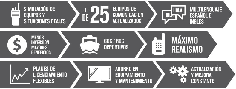
Con más de 25 equipos de comunicaciones y navegación y un ágil Editor de Escenarios, Vox Maris es capaz de crear situaciones de emergencia y fallas en el equipamiento, para maximizar la experiencia de aprendizaje. Además, todas las condiciones que afectan a las comunicaciones marítimas, como ruido, filtros, atenuación y horario, son reproducidas con máximo realismo.
Vox Maris tiene dos módulos, el de Instructor y el de Alumno, dándole a cada rol los recursos necesarios para la formación, el desarrollo de habilidades y el control en tiempo real para supervisar y evaluar el rendimiento de cada alumno. Está disponible en inglés y español, con un desarrollo específico en lenguaje nativo.
- Software y hardware de uso común, sin necesidad de equipos dedicados a la simulación de audio.
- Permite dar soporte a la evolución tecnológica y normativa del SMSSM sin necesidad de volver a adquirir versiones del simulador.
- Utilizado por más de 150 universidades, escuelas y centros de formación marítima de todo el mundo
- Soporte y asesoramiento profesional
- Más de 25 equipos de comunicación actualizados
- Simulación de equipos y situaciones comunes en tiempo real (Escuchar comunicaciones, ver pantallas de alumnos, tomar control remotamente, Observar estado de los dispositivos, grabar el video de las acciones)
- Su editor de escenarios permite: Ubicar gráficamente buques, estaciones costeras, blancos AIS, etc. Crear eventos que conllevan la toma de decisiones, Generar fallas en los equipos de comunicaciones, transmitir audios pregrabados, difundir mensajes DSC de distintas categorías, transmitir mensajes NAVTEX/SafetyNET y activar SARTs, AIS-SARTs y EPIRBs
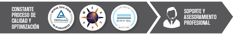
Cumple los requisitos de la OMI, la UIT, el STCW’95 y el convenio SOLAS. Está certificado por Det Norske Veritas como Simulador GMDSS de Clase A y por la Association of Marine Electronic and Radio Colleges (AMERC, Reino Unido). También cuenta con homologaciones emitidas por prestigiosas Autoridades Marítimas: la Dirección General de la Marina Mercante de España, la Armada Argentina, DIRECTEMAR de Chile, la Armada Polaca, y la Autoridad Marítima de Indonesia.

Internacionales
Homologaciones emitidas por la Autoridad Marítima de España
Dirección General de Marina Mercante
Avales emitidos por Centros de Formación Marítima de la Armada Argentina
Aval emitido por Centro de Formación Marítima de la Armada de Polonia


